
Executive Overview
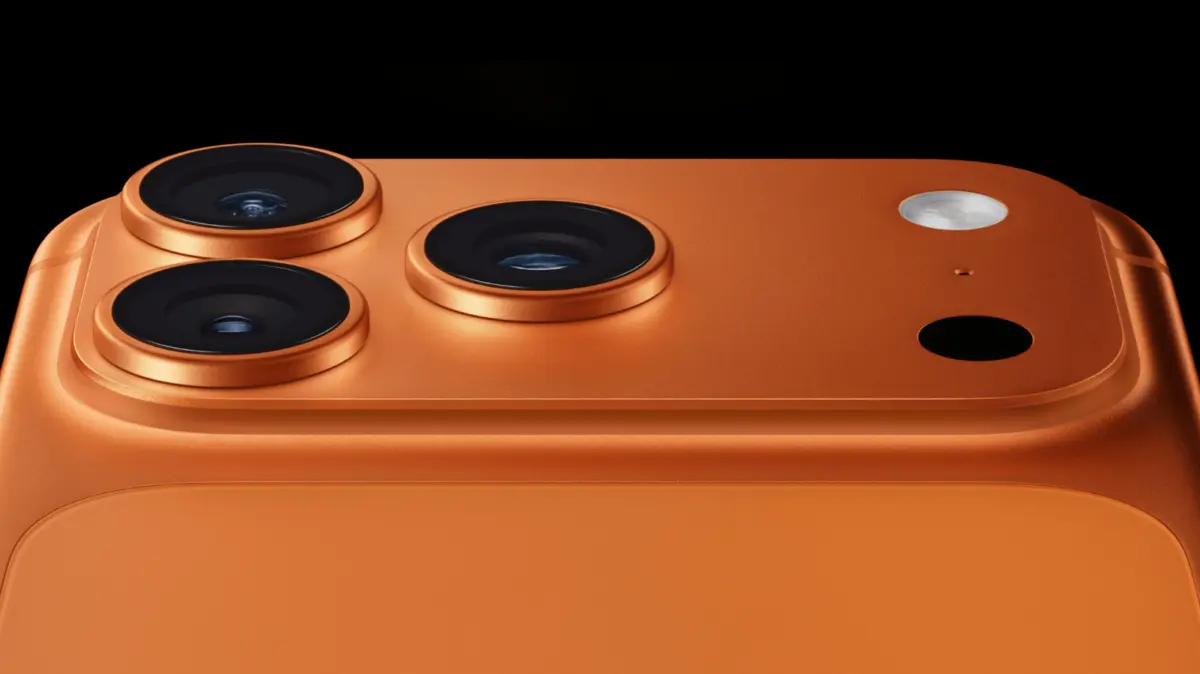
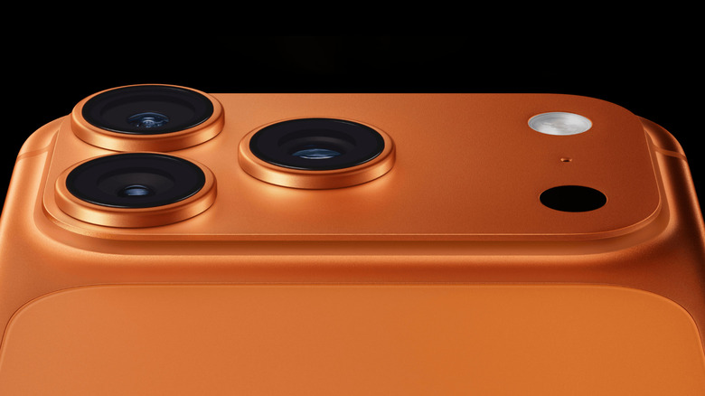
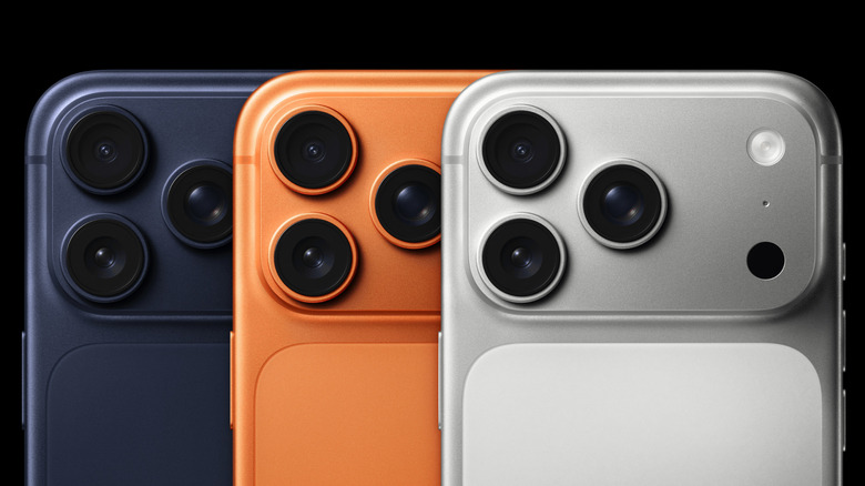
Tucked neatly into the rear camera modules of Apple’s flagship Pro and Pro Max smartphone lineups lies a feature that easily goes unnoticed by the casual user. It is not an additional camera lens, nor is it a specialized flash module. It is a small, dark circular aperture known as the LiDAR scanner. Short for "Light Detection and Ranging," this sophisticated piece of hardware was once reserved for high-end cartography, autonomous vehicle navigation, and expensive industrial surveying equipment. Today, however, it sits quietly in the pockets of millions of consumers worldwide.
Despite its powerful capabilities, LiDAR remains an enigma to many iPhone owners. There is no dedicated application icon on the iOS home screen labeled "LiDAR," nor is there a master toggle switch tucked away within the deep menus of the Settings app. Instead, the sensor operates invisibly in the background, quietly orchestrating a symphony of depth-sensing, environmental mapping, and spatial computation. Whenever an augmented reality application maps a living room, a camera app achieves instantaneous low-light autofocus, or an accessibility feature detects obstacles for a visually impaired user, LiDAR is hard at work.
This comprehensive guide delves deep into the mechanics of iPhone LiDAR, tracing its historical integration into Apple’s ecosystem, exploring its multifaceted technical applications, and providing a practical roadmap for harnessing its potential in daily life.
Detailed Chronology: The Evolution of LiDAR in Apple Devices
To understand how LiDAR arrived in the palm of our hands, it is necessary to examine Apple’s methodical integration of depth-sensing technology over the past decade. The journey did not begin with the iPhone; rather, it was forged through the rapid development of augmented reality frameworks and iPad hardware.
The Foundation: ARKit and Early Depth Sensing (2017–2019)
Long before hardware-based LiDAR arrived on mobile devices, Apple laid the software groundwork via ARKit. Introduced in 2017 alongside iOS 11, ARKit allowed developers to build immersive augmented reality experiences by utilizing standard RGB camera feeds combined with motion sensors (IMUs) to estimate scale and plane surfaces. However, these early iterations relied heavily on software estimation, which frequently resulted in jittery virtual object placement and surface-tracking errors in complex lighting environments.
The Hardware Breakthrough: iPad Pro and iPhone 12 Pro (2020)
The paradigm shifted dramatically in March 2020, when Apple unveiled the fourth-generation iPad Pro, marking the debut of LiDAR in a consumer-facing Apple product. Just a few months later, in October 2020, Apple expanded this hardware capability to the smartphone tier with the launch of the iPhone 12 Pro and iPhone 12 Pro Max.
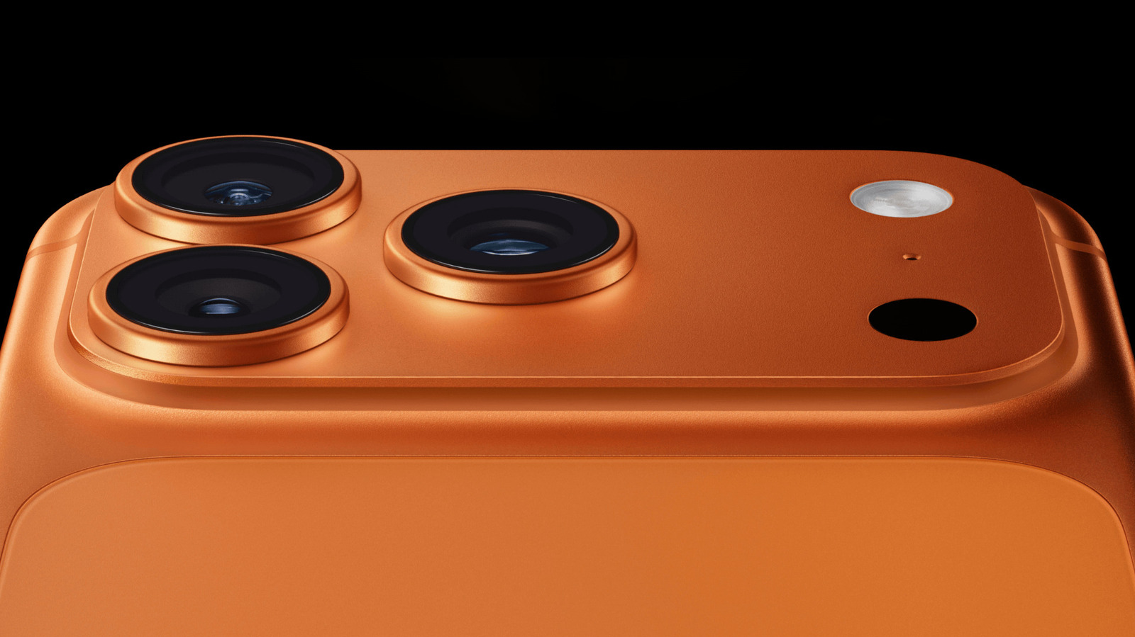
By integrating a direct time-of-flight (ToF) scanner into the rear camera array, Apple bridged the gap between digital processing and physical reality. The iPhone 12 Pro generation utilized LiDAR not only to accelerate autofocus in dim environments by up to six times, but also to drastically improve portrait photography in Night mode by mapping foreground and background planes with pinpoint accuracy.
Refinement and Pro-Exclusivity (2021–Present)
Following its introduction, LiDAR quickly solidified its status as a differentiator for Apple’s "Pro" branding. Through successive generations—including the iPhone 13 Pro, iPhone 14 Pro, iPhone 15 Pro, iPhone 16 Pro, and the cutting-edge iPhone 17 Pro and Pro Max lineups—the underlying technology has undergone continuous refinement.
While base-tier models, "Plus" variants, and standard iPhones continue to omit the sensor in favor of cost-efficiency and internal space optimization, Apple’s Pro ecosystem has leaned heavily into LiDAR. The introduction of frameworks like RoomPlan in iOS 16 transformed the sensor from a photographic assistant into a powerful architectural and spatial-mapping utility, proving that Apple views LiDAR not as a fleeting gimmick, but as a foundational pillar of its long-term spatial computing strategy.
Supporting Context & Metrics: How LiDAR Works Under the Hood
To fully appreciate what the LiDAR sensor accomplishes, one must examine the physics behind the technology and the quantitative metrics that define its performance.
The Mechanics of Light Detection and Ranging
At its core, LiDAR operates on a remarkably straightforward physical principle: the measurement of time.
- Pulse Emission: The sensor houses a vertical-cavity surface-emitting laser (VCSEL) that projects invisible, eye-safe pulses of infrared light into the physical environment.
- Reflection: These photons travel outward until they strike a physical surface—be it a human face, a living room wall, a tree branch, or a piece of furniture—and bounce back toward the sensor.
- Detection & Timing: A specialized photodetector captures the returning photons. By calculating the exact nanoseconds it took for the light to make the round trip, combined with the known speed of light, the system computes precise distance metrics.
This process happens at astonishing speeds, firing hundreds of thousands of invisible laser pulses per second to construct a continuous, high-fidelity depth map of the user’s surroundings.
Spatial Meshing and ARKit Integration
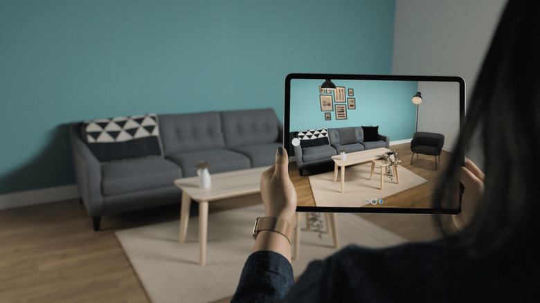
When combined with data from the iPhone’s wide-angle and ultra-wide-angle cameras, the depth readings from the LiDAR scanner allow Apple’s ARKit framework to generate a real-time 3D mesh of the physical environment.
| Metric / Feature | Standard iPhone Models | iPhone Pro / Pro Max Models |
|---|---|---|
| Primary Camera Array | Dual-Lens (Wide, Ultra Wide) | Triple-Lens (Wide, Ultra Wide, Telephoto) |
| Dedicated Depth Sensor | None | Hardware LiDAR Scanner |
| Low-Light Autofocus | Standard contrast/phase detection | Enhanced via LiDAR ranging |
| Night Mode Portraits | Unsupported | Supported via depth mapping |
| Room Scanning Apps | Software-estimated (ARKit) | High-precision (RoomPlan & LiDAR) |
| Magnifier Detection Mode | Basic visual processing | Advanced spatial & haptic feedback |
While standard iPhones must estimate depth using visual cues and algorithmic guesswork, Pro models utilize direct physical measurements. This difference is stark when rendering augmented reality: virtual objects dropped onto a physical floor via LiDAR-equipped devices will realistically occlude behind real-world furniture, fall naturally onto tabletops, and maintain absolute spatial stability.
Practical Applications: How to Use LiDAR on Your iPhone
Because LiDAR runs natively at the operating system level, you will not find an application named "LiDAR" on your device. Instead, the sensor’s capabilities are woven into various built-in tools and third-party applications. Below is a breakdown of how everyday users can interact with this technology.
1. Precision Measurement with the Measure App
Apple’s pre-installed Measure app serves as the most accessible entry point for testing the capabilities of the LiDAR sensor.
- Manual Estimation: Open the Measure app and pan your device slowly across a room. A white dot within a circle will appear on screen. Align this dot with the starting point of an object, tap the Plus (+) button, drag the target to the opposite end, and tap Plus (+) again to reveal an estimated length.
- Pro-Exclusive Enhancements: On LiDAR-equipped iPhone Pro models, the Measure app unlocks automated features. When the camera detects the edges of a rectangular object (such as a picture frame or a table), it automatically displays bounding box dimensions. Furthermore, the app features a Ruler View for granular increments and an automatic height-measurement tool that instantly logs a person’s height the moment they enter the camera frame.
2. Interior Mapping and Room Design via RoomPlan
For professionals in real estate, interior design, and architecture—or for DIY homeowners planning a renovation—Apple’s RoomPlan framework represents a massive leap forward.
Third-party applications built on RoomPlan leverage the iPhone Pro’s camera and LiDAR sensor to sweep an interior space, automatically identifying and cataloging structural elements such as walls, windows, doors, and architectural openings. Within minutes, the application generates a structured 3D CAD or USDZ model of the room, complete with accurate dimensions and furniture classifications, which can then be exported into professional design software.
3. Photographic Enhancements
While users rarely think of photography as a spatial computing task, LiDAR plays a vital role in capturing professional-grade imagery on Pro iPhones:
- Accelerated Low-Light Focus: In dark environments where traditional autofocus struggles to detect contrast, LiDAR instantly measures the distance to the subject, allowing the lens to lock focus up to six times faster.
- Night Mode Portraits: Creating a background blur (bokeh) effect relies on separating the subject from the background. LiDAR provides an accurate depth map even in near pitch-black conditions, enabling crisp, beautifully separated Portrait Mode shots long after the sun has set.
4. Accessibility and Spatial Awareness
One of the most profound applications of iPhone LiDAR lies in its utility for the visually impaired. Within the system Magnifier application, users can activate Detection Mode.
Using LiDAR depth data combined with machine learning, Detection Mode can identify physical obstacles in the user’s immediate path—such as other people, doors, seating, and furniture. The phone communicates this spatial data back to the user through a combination of spoken word announcements, distinct auditory tones, and nuanced haptic feedback patterns.
(Note: Apple explicitly cautions that while Detection Mode is a powerful assistive tool, it should never be relied upon as a primary navigation aid in high-risk or potentially hazardous environments.)
Future Outlook: The Road Ahead for Mobile Depth Sensing
As spatial computing transitions from a nascent technology into an integrated component of modern consumer electronics, the role of LiDAR within the Apple ecosystem is poised to expand exponentially.
Industry analysts and supply chain insiders suggest that depth-sensing hardware will continue to see generational refinements, resulting in smaller sensor footprints, lower power consumption, and longer effective ranges. As augmented reality hardware—such as Apple Vision Pro—continues to mature, the iPhone’s ability to rapidly scan, map, and export high-fidelity spatial data positions it as an essential content-creation hub for the spatial web.
Moreover, as machine learning models become more efficient at processing dense point clouds generated by LiDAR, developers will unlock unprecedented use cases in fields ranging from interactive mobile gaming and remote telehealth to augmented reality commerce and interactive education.
What began as a modest dark circle on the back of the iPhone 12 Pro has evolved into a quiet powerhouse of spatial awareness. For owners of Apple’s Pro and Pro Max devices, LiDAR represents a window into a future where the digital and physical worlds seamlessly and intelligently merge.