
Executive Overview
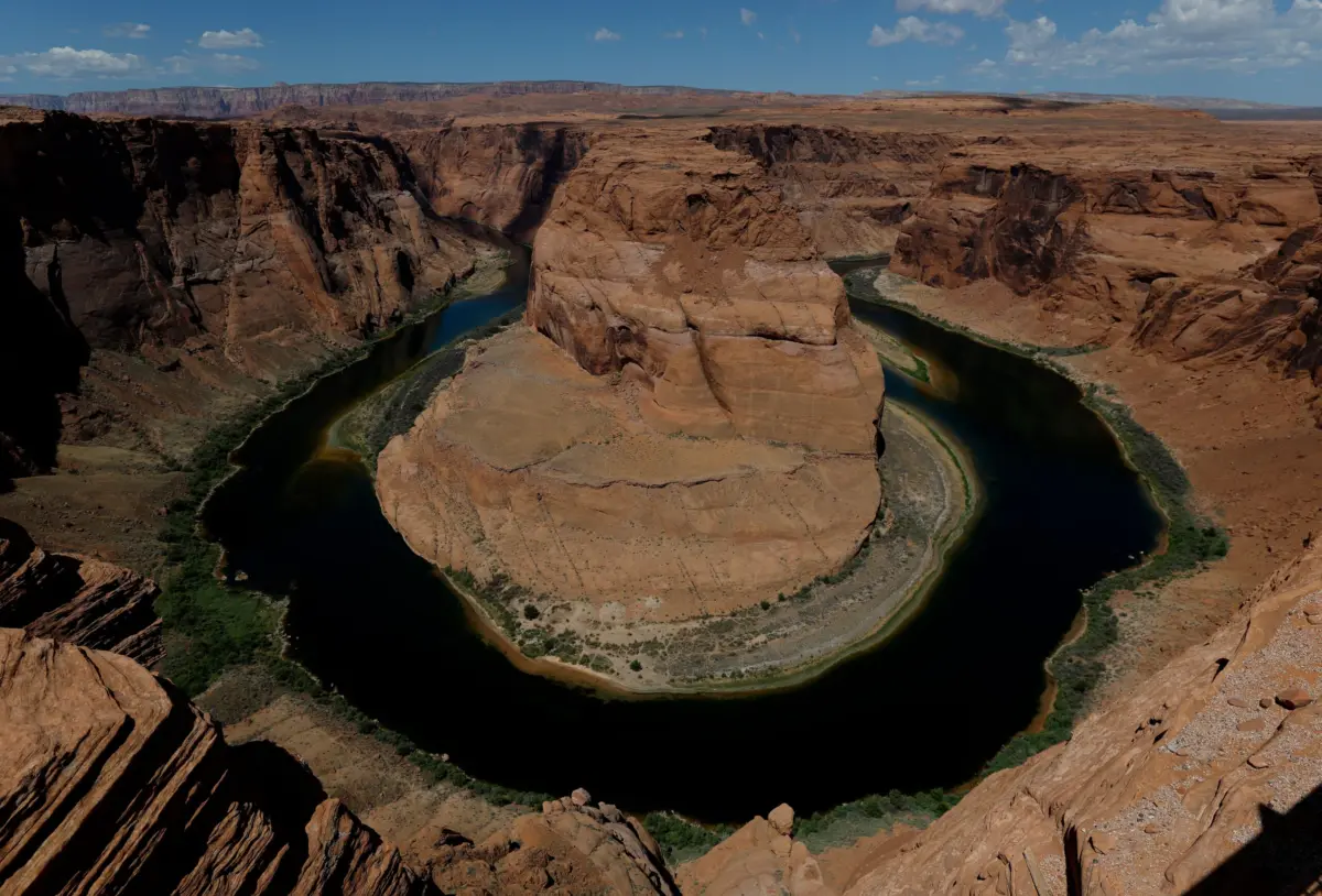
The Colorado River is facing an existential reckoning. For decades, scientists, environmentalists, and regional water managers have warned that the lifeblood of the American Southwest was careening toward an unsustainable future. Today, that theoretical crisis has fully materialized. Providing crucial sustenance, drinking water, and agricultural irrigation to 40 million people across seven states and tribal nations, the river system is gasping for air. At the heart of this unfolding catastrophe are Lakes Mead and Powell—the two largest man-made reservoirs in the United States—which have plummeted to unprecedented, record-low elevations.
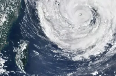
As the system approaches these alarming thresholds, meteorologists and climatologists are casting their gaze toward the Pacific Ocean, where a historically powerful El Niño weather pattern is taking shape. Potentially the strongest of its kind in recorded meteorological history, this phenomenon raises the tantalizing prospect of increased winter and spring precipitation across the southwestern United States. For a parched region desperate for relief, it represents a glimmer of hope.
Yet, leading hydrologists and climate scientists offer a sobering consensus: El Niño is not a silver bullet. Even under an idealized, best-case scenario featuring heavy winter snowpacks and localized downpours, a single season of generous weather cannot reverse decades of structural over-allocation, chronic warming trends, and relentless climate change. Compounding this environmental emergency is a ticking political time bomb. A century-old compact governing the division of the river’s waters is expiring, and regional stakeholders have repeatedly missed critical deadlines to forge a sustainable successor.
As the margins for error evaporate, the American Southwest stands at a historical crossroads. The choices made—or neglected—in boardrooms, legislative chambers, and federal agencies over the coming months will dictate the habitability and economic viability of an entire region for generations to come.
Detailed Chronology: How the Crisis Accelerated
To understand the severity of the current emergency, one must examine the systematic erosion of the Colorado River basin over the past century, and how a slow-moving administrative and ecological disaster suddenly accelerated into a modern emergency.
1922: The Flawed Foundation
The allocation of the Colorado River’s water is anchored in the 1922 Colorado River Compact, an agreement brokered among the seven basin states: Colorado, Wyoming, Utah, and New Mexico in the Upper Basin; and Arizona, California, and Nevada in the Lower Basin. Drafted during an unusually wet statistical period, the compact significantly overestimated the river’s long-term annual flow, dividing up more water than the river actually possessed. For decades, this mathematical fiction was masked by the construction of massive engineering marvels, most notably Hoover Dam (creating Lake Mead) and Glen Canyon Dam (creating Lake Powell).
The Late 20th to Early 21st Century: The Structural Deficit Begins
As populations in desert metropolises like Phoenix, Las Vegas, and Los Angeles boomed, and as intensive industrial agriculture dug deeper roots across arid valleys, the demand for water consistently outstripped supply. For years, the system operated on a structural deficit. Water was drawn out of Lakes Mead and Powell faster than rain and snow could replenish them.
The 2000s–2020s: The Aridification of the West
Entering the twenty-first century, a multi-decade megadrought—worsened significantly by anthropogenic climate change—took hold of the American West. Winter temperatures climbed steadily, transforming what historically fell as heavy, insulating mountain snow into fleeting rain. Mountain snowpacks, which act as natural frozen reservoirs storing water through the winter and releasing it gradually during spring melts, shrank dramatically.
The Present Crisis: Hitting Rock Bottom
The compounding pressures culminated in a disastrous hydrological season. Record-breaking warm winter temperatures across the West led to some of the lowest snowpack levels ever recorded in the Upper Basin mountain ranges. Consequently, inflows into the river system shriveled.
By mid-month, the metrics reached historic lows:
- Lake Powell dropped to an alarming 3,519.4 feet above sea level.
- Lake Mead descended to a precarious 1,039.6 feet above sea level.
These figures are not merely symbolic; they bring the reservoirs dangerously close to "dead pool" status—the absolute threshold where water level elevations fall too low to flow downstream through the dams’ outlets by gravity alone. For Lake Powell, dead pool occurs at 3,370 feet; for Lake Mead, it is 895 feet. Long before absolute dead pool is reached, however, hydroelectric power generation from both reservoirs will grind to a halt, cutting off vital carbon-free electricity to millions of homes and businesses across the region.
Supporting Context & Metrics: The Science of the Basin
The mechanics of the Colorado River watershed are complex, dictated by geography, climate physics, and shifting meteorological baselines.
The Upper Basin vs. Lower Basin Dynamic
The Colorado River spans 1,450 miles, drawing roughly its entire volume from snowmelt originating in the high-altitude Rocky Mountains of the Upper Basin states (Colorado, Utah, New Mexico, and Wyoming). This water flows downstream through the Grand Canyon, feeding Lakes Powell and Mead, which in turn sustain the Lower Basin states (California, Arizona, and Nevada) as well as parts of Mexico.
Because the Upper Basin relies almost entirely on winter snowfall, its meteorological conditions dictate the health of the entire river. When the Upper Basin experiences a warm winter and poor snowpack, the ripple effects are felt downstream in the form of rapidly retreating shorelines and dwindling agricultural allotments.
The El Niño Factor: Promise vs. Reality
As the basin struggles, all eyes have turned to the Pacific Ocean and the development of a super El Niño event. El Niño is a climate pattern characterized by warmer-than-average sea surface temperatures in the central and eastern tropical Pacific Ocean. It fundamentally alters global atmospheric circulation, shifting jet streams and steering storm tracks across North America.
Climatologists note that a strong El Niño reliably loads the dice for wet winters across the southern tier of the United States. States like Southern California, Arizona, New Mexico, and the Gulf Coast frequently experience above-average precipitation during these cycles.
However, experts urge caution against viewing El Niño as a cure-all for the Colorado River:
- Targeting the Wrong Basin: El Niño storms typically deliver moisture to the southern portions of the West and Southwest. They do not reliably dump heavy snowpack into the Upper Basin mountain ranges (Colorado, Wyoming, Utah, and New Mexico) where the Colorado River actually captures its water. During the last "very strong" El Niño in the winter of 2015–2016, the Upper Basin saw only a completely average amount of snowfall.
- The Climate Change Baseline Shift: Anthropogenic warming has fundamentally altered how precipitation interacts with the landscape. Modern winter storms arrive in a warmer atmosphere. Consequently, precipitation frequently falls as rain rather than snow, or snowpacks melt prematurely. Furthermore, moisture that does reach the ground is often intercepted by parched, baking soils or re-evaporated directly into an increasingly thirsty, warmer atmosphere.
As University of California Agriculture and Natural Resources climate scientist Daniel Swain notes, modern precipitation simply does not have the same hydrological efficiency as a good snow year did in decades past. Even under optimal storm conditions, the structural deficits of the basin outpace single-season recoveries.
Official Statements and Expert Perspectives
The gravity of the situation has united scientists, policy experts, and resource managers in a chorus of urgent warnings. The narrative has shifted from mitigating a future risk to managing an active, unfolding catastrophe.
"People have talked about the Colorado River crisis for decades—we’re now in it. Everyone you talk to is like, ‘Shit, man. This is the year. Next year is the year.’ We’re really going to see: Can we get through it?"
— John Berggren, Policy Manager at Western Resource Advocates
Berggren’s sentiment echoes through water districts, agricultural cooperatives, and state capitals across the West. The psychological threshold has been crossed; denial has given way to emergency preparedness.
Berkeley Earth climate scientist Zeke Hausfather emphasizes the geographic mismatch of El Niño benefits:
"A strong El Niño does load the dice toward a wet winter across the southern US, from Southern California through Arizona and New Mexico to the Gulf Coast… But peer-reviewed correlations between El Niño and Upper Basin snowpack or streamflow are modest at best."
Daniel Swain of UCLA further underscores the unprecedented nature of the meteorological forces at play, noting that a standard El Niño and a historically massive "super" El Niño function almost as entirely distinct phenomena. Yet, he warns that even the most dramatic single-season weather anomalies are ultimately swallowed by long-term climatic drying trends:
"Even one big year is not going to save us. It might be a sigh of relief, but we’ll be right back in it."
Compounding the ecological anxiety is the policy vacuum. With the 1922 compact expiring at the end of the year, federal regulators have been forced to step in as state negotiators repeatedly miss self-imposed deadlines to draft a new operational framework. The inability of the seven basin states to voluntarily agree on equitable water-cut distributions has turned an environmental crisis into a high-stakes political standoff.
Future Outlook: Navigating an Uncertain Horizon
The path forward for the Colorado River basin is fraught with difficult choices, legal battles, and necessary economic transformations. As climate projections indicate that the river’s overall flow could shrink by as much as 30 percent by 2050, business-as-usual management is no longer an option.
1. Re-Engineering Agricultural Water Use
Agriculture accounts for roughly 70 to 80 percent of all water consumption from the Colorado River, supporting vital feed crops like alfalfa and pasture grass. Moving forward, federal and state programs must accelerate financial incentives for farmers to adopt high-efficiency drip irrigation, fallow fields rotationally, or transition to less water-intensive crops. Without significant agricultural conservation, municipal water restrictions alone will fail to balance the ledger.
2. Modernizing Governance and Interstate Compacts
The expiration of the century-old river compact presents a generational opportunity—and a terrifying risk. Federal intervention is currently keeping the peace, but a long-term, legally binding framework must be established. Future allocations must be decoupled from historical over-estimates and tied directly to real-time, science-based hydrological data that accounts for ongoing aridification.
3. Infrastructure and Technological Adaptation
As Lakes Mead and Powell drift closer to dead pool elevations, water managers are investing heavily in infrastructure resilience. This includes tapping into deeper outlet structures, expanding advanced water recycling and purification plants in urban centers like Los Angeles and Las Vegas, and exploring large-scale desalination projects along the Pacific coast to offset reliance on the river.
Conclusion
The crisis on the Colorado River is a stark preview of a rapidly warming world. While an exceptionally strong El Niño may offer a temporary reprieve—a brief pause in an otherwise relentless downward spiral—it cannot substitute for systemic reform. Forty million people, sprawling agricultural economies, and delicate desert ecosystems depend on the outcome. The time for debate has passed; the era of adaptation, sacrifice, and survival has begun.