
Executive Overview
While public outcry has repeatedly drawn national attention to the ecological scars left by border infrastructure tearing through pristine desert landscapes in Big Bend National Park, a quieter, equally devastating battle is unfolding across the private ranches of West Texas. Here, the United States border wall initiative—funded by billions of dollars in federal contracts awarded by the Department of Homeland Security (DHS) and Customs and Border Protection (CBP)—is slated to carve through some of North America’s richest, most fragile archaeological sites.
The multi-billion-dollar push targets a remote, 500-plus-mile riverfront expanse along the US-Mexico border. Although bipartisan backlash successfully forced the DHS to scrap its original plans for a 30-foot steel bollard wall within Big Bend National Park—replacing it with riverside vehicle barriers and road construction—the broader project marches forward. Bulldozers, staging areas, and temporary workforce "man camps" have altered the geography of the borderlands.
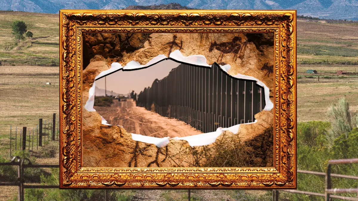
Outside the protective boundaries of the national parks, on generational private ranches, the stakes are existential. Archaeologists and landowners warn that construction threatens to unearth ancient Indigenous artifacts, permanently fracture millennia-old rock art, and bifurcate working agricultural lands. Compounding the crisis is a sweeping legal exemption: the DHS has waived dozens of federal preservation laws, sidelining statutory requirements to minimize harm to National Historic Landmarks. For the ranchers and researchers fighting to protect these ancient landscapes, the impending construction represents not just an intrusion on private property, but the potential erasure of unrecorded human history.
Detailed Chronology: From Big Bend Outrage to Private Land Incursions
The Catalyst: Big Bend and the Initial Backlash
The modern chapter of this border construction push began when the DHS and CBP awarded massive federal contracts to secure West Texas’s rugged riverfront. The plan initially envisioned a towering 30-foot steel bollard wall slicing through the ecologically sensitive and visually arresting terrain of Big Bend National Park.
The response was swift and furious. Conservationists, politicians, and park advocates mounted a bipartisan campaign against the park barrier, arguing it would irrevocably disrupt wildlife corridors and deface iconic vistas near Santa Elena Canyon. Yielding to this pressure, the DHS altered its course on August 6, shelving the steel bollard design within the park in favor of miles of riverside vehicle barriers and over 200 miles of associated road construction. Heavy machinery wasted no time; bulldozers began clearing vegetation along the Rio Grande corridor that very day.
Legal Stalls and the Shift to Private Ranches
Though lawsuits temporarily halted active construction within Big Bend National Park, the overarching federal strategy remained unchanged. The DHS pivoted its focus to the rugged terrain just outside the park’s borders—specifically, private ranchlands stretching across the West Texas desert.
Unlike public parklands, which benefit from baseline federal oversight, many of these private tracts harbor undocumented archaeological treasures that have never been systematically studied. As heavy machinery advanced toward private property, landowners reported contractors clearing land and damaging local irrigation systems ahead of formal legal authorization.
Despite mounting legal resistance—such as lawsuits filed by families in towns like San Ygnacio further south—the groundwork for the barrier continues. Staging areas filled with towering piles of steel bollards and temporary housing developments for construction crews have transformed remote desert vistas, setting the stage for a permanent physical division of the borderlands.
Supporting Context & Metrics: The Archaeological Jewels at Risk
Canta Recio and the Rio Grande’s Ancient Settlers
The threat to West Texas history is exemplified at Canta Recio, an archaeological dig site situated directly in the path of the proposed wall on rancher Jeff Fort’s property. For two years, Bryon Schroeder, director of Sul Ross State University’s Center for Big Bend Studies, has meticulously excavated the site, removing sediment just 4 inches (10 centimeters) at a time.

Schroeder’s work has revealed a complex picture of ancient habitation. His team has uncovered pottery, melted adobe slick building material dating back to AD 800, turquoise, and marine shells. These items serve as undeniable proof of long-distance trade networks, linking the site directly to Paquimé, a UNESCO World Heritage site located 200 miles south in Mexico.
Schroeder compares the settlement patterns of Canta Recio to the ancient Egyptians along the Nile. Between 800 and 1400, groups repeatedly settled the area, drawn by the fertile soil deposited by routine seasonal floods. These same floods, however, periodically forced inhabitants to abandon their homes when the Rio Grande overtopped its banks, only for new groups to return once the silt stabilized.
"There’s some bigger, cooler sites up the river that are just insane," Schroeder notes, highlighting the presence of Mesoamerican copper bells, rare turquoise, and vast quantities of ancient pottery that remain vulnerable to impending construction.
The Lower Pecos Canyonlands and Painted Shelter
Further downriver in Comstock, Texas—a town of just 268 residents—rancher Patrick Zuberbueler watches the unfolding crisis with deep dismay. Zuberbueler grew up exploring the limestone canyons of his family’s ranch, which has been worked by his family since his great-grandfather arrived in 1898.
As a child, Zuberbueler picnicked in the shadow of Painted Shelter, a massive limestone rock shelter adorned with complex artwork created between 1,000 and 6,000 years ago. To Dr. Carolyn Boyd, a research professor at Texas State University and founder of the Shumla Archaeological Research and Education Center, Painted Shelter is far more than a scenic landmark; it is one of the most critical archaeological sites in North America.
"Rock artworks encode stories and cosmologies," Boyd explains, describing the vibrant, multi-layered murals—some towering 50 feet high and stretching hundreds of feet wide—as irreplaceable "libraries of human knowledge."
The proposed border barrier sits directly above Painted Shelter. Boyd warns that the construction of a vehicle barrier and the heavy vibrations from machinery could trigger catastrophic geological damage, causing the ancient limestone canvas to spall, or flake off in sheets, destroying the art forever. Across the Lower Pecos Canyonlands Archaeological District, Boyd has identified 12 additional rock art sites at immediate risk from construction, while another 79 will be rendered completely inaccessible to researchers and landowners.
The Polvo Site and Eagle Nest Canyon
The destruction is not isolated to Painted Shelter. Further west in Redford, Texas, the historic Polvo site—home to a prehistoric village and burial grounds dating back to the 1300s, alongside the remains of a 17th-century Spanish mission—stands directly in the path of a planned 30-foot bollard wall. Similarly, Eagle Nest Canyon in Langtry, one of the most intensively studied and significant archaeological sites in Texas, is slated to be bisected by physical barriers. Eagle Nest Canyon features the southernmost known bison jump site in the US, where ancient Native Americans hunted herds en masse by driving them over steep cliffs.
Official Statements and the Legal Framework
The Battle Over Waivers and Preservation Laws
The conflict between federal border security mandates and local heritage preservation highlights a profound legal paradox. The Lower Pecos Canyonlands Archeological District was officially designated as a National Historic Landmark on January 13, 2021. Under standard federal statutes, such as the National Historic Preservation Act, agencies are legally required "to the maximum extent possible undertake such planning and actions as may be necessary to minimize harm" to protected historical sites.

However, these statutory protections have been rendered toothless. To fast-track wall construction, the Department of Homeland Security utilized its sweeping authority under the REAL ID Act to waive dozens of foundational environmental and cultural preservation laws. This legal maneuver bypasses the very impact assessments designed to protect irreplaceable heritage sites.
Federal Assurance Versus Local Reality
In response to inquiries regarding the preservation of cultural resources, a Customs and Border Protection (CBP) spokesperson asserted that the agency actively conducts environmental and cultural reviews. According to the agency, these internal evaluations are designed to minimize ecological and historical impacts while balancing operational border security needs with responsible land stewardship.
Researchers and landowners, however, view these assurances with skepticism. Previous construction projects along the southern border have demonstrated that federal reviews rarely halt infrastructure development, leaving historically significant sites vulnerable to irreversible damage before comprehensive studies can even be completed.
Future Outlook: A Generation Under Threat
For multi-generational ranchers like Patrick Zuberbueler, the border wall represents an existential threat to both their family legacy and their economic viability. Having already surrendered portions of their land to federal eminent domain in the 1960s and 1970s for the creation of the Amistad Reservoir and Seminole Canyon State Park, Zuberbueler’s family ranch continues to shrink.
"The ranch continues to shrink and shrink and shrink, and you can’t effectively ranch something that way," Zuberbueler says. "They’re hurting our livelihood as producers."
Similarly, Dr. Carolyn Boyd describes the ongoing crisis as an exhausting battle to save 6,000 years of unrecorded human history from being paved over in the name of national security. While she holds out hope that federal authorities might eventually listen to reason and pivot toward technological monitoring solutions—such as advanced cameras, sensors, and remote surveillance—rather than physical barriers, the reality on the ground suggests otherwise.
With steel bollards stacked at staging areas and heavy machinery continuing to reshape the landscape, the window to protect these ancient archives is closing rapidly. Yet, local resistance remains steadfast. Bolstered by lawsuits filed by landowners in border communities determined to defend their property rights, residents like Zuberbueler are drawing a hard line.
"It’s almost unfathomable to even put it into context, the different ways that this can be detrimental to us," Zuberbueler reflects. "We’re not going to go down without a fight."