

Executive Overview
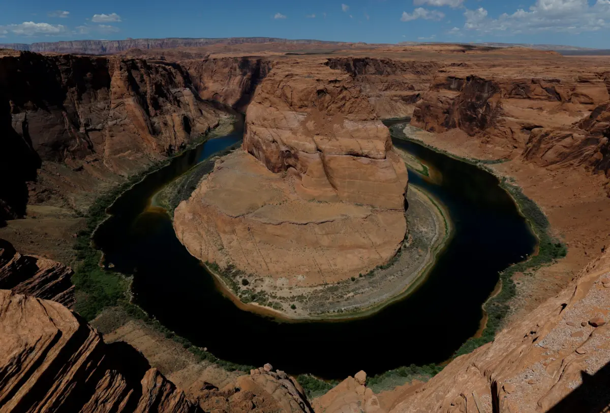
The Colorado River—a critical, 1,450-mile lifeline sustaining roughly 40 million people, vast agricultural empires, and sprawling metropolitan economies across seven U.S. states and two Mexican states—stands at an unprecedented precipice. For decades, scientists, hydrologists, and environmental policy experts have warned of a slow-motion ecological and infrastructural catastrophe unfolding across the American Southwest. Today, that warning is no longer a forecast; it is a present-day reality.
The two largest human-made reservoirs in the United States, Lake Mead and Lake Powell, have plunged to historic, record-low levels, threatening the water security and hydroelectric power generation of the entire region. Into this tense scenario steps an exceptionally powerful El Niño weather pattern, shaping up to be one of the strongest on record. While this meteorological phenomenon brings fleeting hope for increased precipitation across the southwestern United States this winter and spring, experts heavily caution that even a best-case meteorological scenario will be fundamentally insufficient to reverse decades of structural over-allocation, climate change-induced aridification, and systemic policy failures.
Compounding this environmental emergency is a compounding political crisis. A century-old compact governing the division of the river’s waters faces a rapidly approaching expiration date at the end of the year, yet basin states have repeatedly missed critical deadlines to establish a sustainable, long-term framework. As federal regulators step in to mediate an increasingly fractured alliance of water users, the convergence of empty reservoirs, shifting climate baselines, and legal gridlock has transformed the Colorado River basin into ground zero for 21st-century climate vulnerability.
Detailed Chronology: From Bureaucratic Allocation to the Brink of Deadpool
To understand how the Colorado River reached its current crisis point, one must look backward through a century of political maneuvering and hydro-engineering.
The Original Sin: The 1922 Compact
The foundational architecture of the river’s management was established via the Colorado River Compact of 1922. Negotiated during an unusually wet hydrological decade, the agreement divided the basin into an Upper Basin (Colorado, Utah, New Mexico, and Wyoming) and a Lower Basin (California, Arizona, and Nevada), allocating an estimated 16.5 million acre-feet of water annually.
Unfortunately, tree-ring data and long-term historical records later revealed that the compact vastly overestimated the river’s natural yield, promising more water than the watershed historically produces. For generations, this mathematical deficit was masked by the construction of monumental engineering projects—most notably Hoover Dam, which created Lake Mead in the 1930s, and Glen Canyon Dam, which created Lake Powell in the 1960s. These vast storage vessels acted as shock absorbers, buffering the lower states against dry years. However, they also encouraged unchecked agricultural expansion and explosive urban growth in desert environments like Phoenix, Las Vegas, and Southern California, operating under the dangerous assumption that the water supply was infinite.
The Acceleration of the Drought
As the late 20th century gave way to the 21st, the impacts of human-caused climate change began to fundamentally alter the hydrology of the Rocky Mountains. Winters grew shorter and noticeably warmer, resulting in a dramatic reduction of the winter snowpack—the primary natural storage mechanism that feeds the Colorado River system each spring.
By the early 2020s, the cumulative deficit caught up with the infrastructure. Year after year of below-average snowmelt, paired with soaring temperatures that caused massive evaporative losses and dried out parched soils before runoff could even reach tributaries, sent reservoir levels into a freefall.
The Record-Breaking Lows
The crisis reached grim new milestones when hydrologists recorded historic lows across the basin. Lake Powell fell to a perilous elevation of 3,519.4 feet, while Lake Mead dropped to 1,039.6 feet—both marking the lowest levels ever documented since the reservoirs were initially filled.
These drops are not merely aesthetic; they bring both reservoirs dangerously close to "deadpool status"—the critical elevation thresholds (3,370 feet for Lake Powell and 895 feet for Lake Mead) where water can no longer flow past the dam structures by gravity, effectively cutting off downstream delivery entirely. Long before deadpool is reached, however, declining water heads compromise hydroelectric turbines, threatening regional power grids with catastrophic generation losses and forcing costly operational adjustments.
Supporting Context & Metrics: The Science of Snowpacks, Soils, and Super El Niños
The fragile ecosystem of the Colorado River relies on a delicate balance between winter meteorology and terrestrial hydrology. Understanding why current weather patterns may offer little lasting relief requires examining the hard data.
The Mechanics of the Basin
The Colorado River is fundamentally a snow-fed river. Roughly 70 to 80 percent of its annual flow originates as snowpack in the high-elevation mountain ranges of the Upper Basin states. This frozen water accumulates through the winter months and melts during the spring and summer, flowing down tributaries to fill Lake Powell, which then releases water through Glen Canyon Dam to supply Lake Mead and the Lower Basin states.
The El Niño Paradox
As the region looks for salvation, all eyes have turned toward the Pacific Ocean and the development of a historic El Niño event. El Niño—the warm phase of the El Niño-Southern Oscillation (ENSO)—is notorious for disrupting global weather patterns.
Climate scientists note that a robust El Niño typically acts as a reliable driver of wet weather across specific latitudes of the United States. "A strong El Niño does load the dice toward a wet winter across the southern US, from Southern California through Arizona and New Mexico to the Gulf Coast," explains Zeke Hausfather, a climate scientist at Berkeley Earth.
However, this dynamic presents a geographic mismatch for the Colorado River basin. While Lower Basin states like Arizona and Southern California may experience increased rainfall, the vital Upper Basin—where snow accumulation actually matters for long-term river replenishment—enjoys a much weaker correlation with El Niño events.
During the historic "super" El Niño of the winter of 2015–2016, the Upper Basin experienced only a "normal" snowpack. "Peer-reviewed correlations between El Niño and Upper Basin snowpack or streamflow are modest at best," Hausfather notes.
The "Super" El Niño vs. Baseline Aridification
Daniel Swain, a climate scientist at the University of California Agriculture and Natural Resources, emphasizes that a standard El Niño and a "ridiculously strong" El Niño operate under starkly different rules. While extreme El Niño events can occasionally push storm tracks northward enough to clip parts of the Upper Basin, the broader backdrop of climate change has radically shifted baseline environmental conditions.
In previous decades, a wet winter delivered high-yield snowpacks that melted predictably into saturated stream channels. Today, higher baseline temperatures mean that winter precipitation frequently falls as rain rather than snow. Furthermore, exceptionally dry soils hungry for moisture act like a sponge, soaking up precipitation or allowing it to re-evaporate directly into a thirstier, warmer atmosphere before it can ever contribute to runoff.
"That won’t have the same effect as a good snow year in 1980 or 1990," Swain warns. Consequently, even if mountainous regions receive heavy precipitation, structural water yields remain suppressed. Projections indicate that climate change could shrink the Colorado River’s overall baseline flow by as much as 30 percent by the year 2050.
Official Statements and Expert Perspectives: "We’re Now In It"
The psychological turning point among basin managers and environmental scientists is palpable. For decades, the water crisis was framed as an impending horizon—a theoretical challenge to be solved by future generations. Today, experts agree that the horizon has arrived.
"People have talked about the Colorado River crisis for decades—we’re now in it," says John Berggren, a senior policy manager at the environmental nonprofit Western Resource Advocates. "Everyone you talk to is like, ‘Shit, man. This is the year. Next year is the year.’ We’re really going to see: Can we get through it?"
Berggren and other policy analysts stress that while an exceptionally snowy winter can provide psychological and temporary hydrological relief, it should not be mistaken for a permanent fix. "Even one big year is not going to save us," Berggren emphasizes. "It might be a sigh of relief, but we’ll be right back in it."
This sentiment is echoed by federal regulators and state negotiators who spent the past year locked in tense, high-stakes negotiations over mandatory water-use cuts. For generations, voluntary conservation agreements proved insufficient, forcing the Department of the Interior to step in and compel downstream states to accept painful reductions in their legal water allocations. With the century-old compact framework expiring, federal oversight has become the primary mechanism preventing total administrative gridlock among competing agricultural districts, tribal nations, and rapidly growing metropolitan municipalities.
Future Outlook: Navigating the Post-Compact Era
As the Colorado River basin enters this uncharted era, the path forward demands a fundamental reimagining of how water is valued, distributed, and consumed in the American West.
1. Modernizing Governance and Water Rights
The expiration of the 1922 Compact framework presents a once-in-a-generation opportunity to modernize river management. Future agreements must move away from rigid, volume-based allocations rooted in historical over-estimates and transition toward flexible, percentage-based sharing models that automatically adjust water delivery based on actual, measured snowpack and reservoir levels.
2. Agricultural Innovation and Urban Efficiency
Agriculture accounts for roughly 70 to 80 percent of all water consumption from the Colorado River, primarily used to irrigate thirsty feed crops like alfalfa and hay in arid desert climates. Long-term sustainability will require accelerated investments in high-efficiency irrigation technology, rotational fallowing agreements, and economic incentives for farmers to transition toward less water-intensive crops. Simultaneously, urban centers must continue expanding aggressive water recycling, advanced desalination partnerships, and strict municipal conservation mandates.
3. Preparing for a Thirstier Future
Even with aggressive conservation and policy reform, climatologists warn that the physical reality of the river is permanently altered. Higher global temperatures and diminished snowpacks mean that the Colorado River of the mid-21st century will simply carry less water than it did in the 20th.
Ultimately, El Niño may offer a temporary stay of execution—a brief meteorological pause that buys beleaguered water managers a few extra months to forge a fragile consensus. But as Lakes Mead and Powell hover precariously above deadpool, the consensus among scientists is absolute: nature is no longer willing to subsidize human over-consumption. The era of reckoning for the American West has officially begun, and survival will depend entirely on humanity’s willingness to adapt to a drier, harsher reality.