

Executive Overview
For decades, the fundamental driving force behind our universe’s accelerated expansion has remained one of the most profound and vexing mysteries in modern astrophysics. Known universally as dark energy, this enigmatic phenomenon pervades every corner of the cosmos, quietly dictating the fate of space-time itself. Yet, despite its overwhelming influence—comprising roughly 70 percent of the total energy density of the universe—scientists know remarkably little about its true nature, origin, or mechanics.
To bridge this massive chasm in human knowledge, an international collective of scientists has spent the past half-decade peering deep into the abyss. Nestled atop a remote, wind-swept mountain in Arizona’s rugged Sonoran Desert, the Dark Energy Spectroscopic Instrument (DESI) has systematically scanned, cataloged, and mapped the heavens. The culmination of this monumental effort is the largest and most detailed three-dimensional map of the universe ever produced.
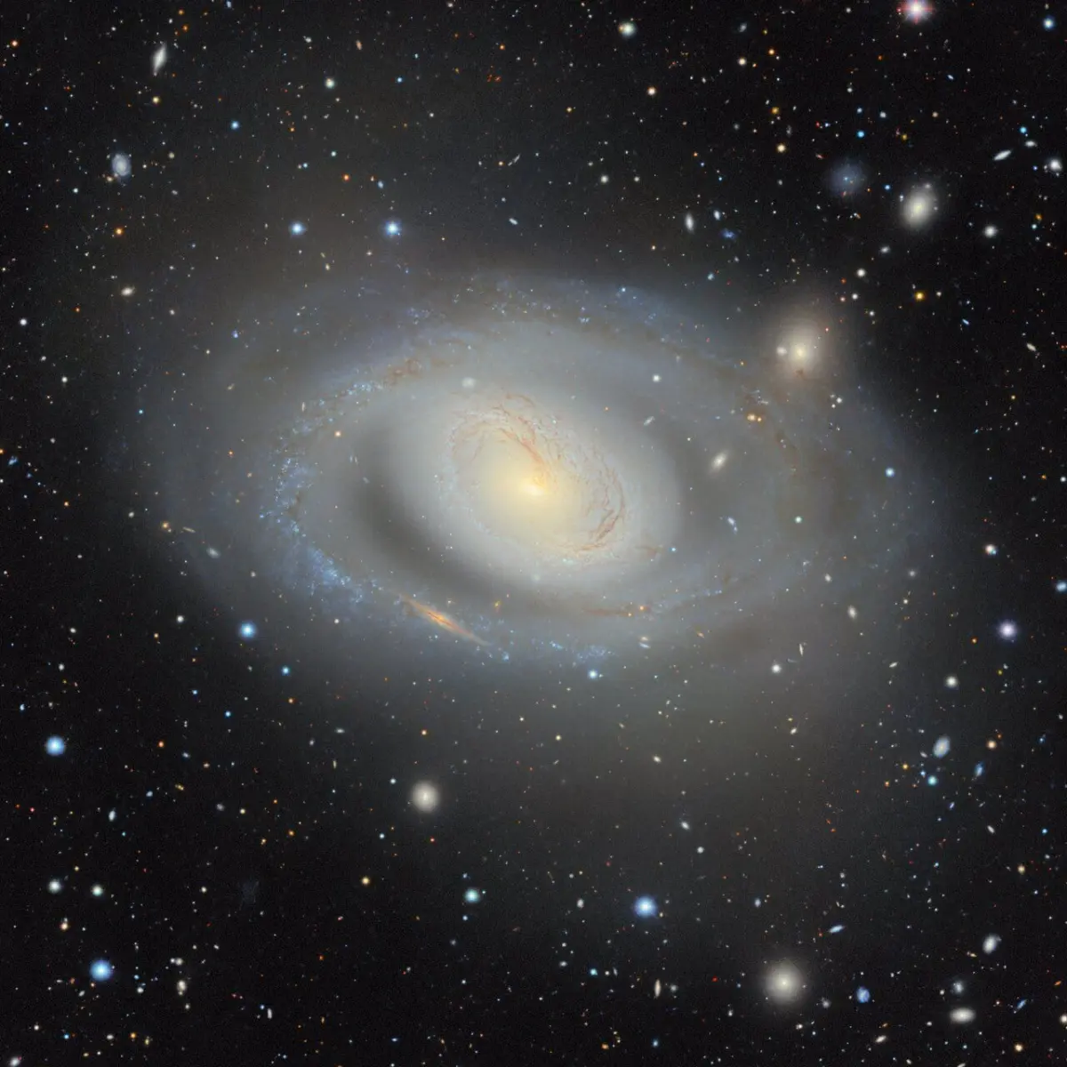
Now, with the public release of the latest iteration of the DESI Legacy Imaging Surveys—a powerful, free online tool that opens up this vast treasure trove of data to the world—professional researchers and amateur stargazers alike can explore the architecture of the cosmos. Boasting an unprecedented 5.6 trillion pixels of high-resolution data, the map catalogs approximately 4 billion individual celestial objects, ranging from ancient stars and sprawling galaxies to elusive black holes and wandering asteroids. Covering roughly 75 percent of the entire night sky in both visible light and near-infrared wavelengths, this digital monument to human curiosity represents a watershed moment in observational astronomy.
Detailed Chronology: From Groundwork to Cosmic Cartography
The monumental success of the DESI Legacy Imaging Surveys was not achieved overnight; it is the culmination of decades of technical innovation, international collaboration, and painstaking astronomical fieldwork.
The Foundation (2000s–2010s)
Long before DESI’s robotic eyes ever turned toward the heavens, the groundwork was laid by predecessor sky surveys that utilized older generations of telescopic technology. The new DESI map directly builds upon more than 13 years of foundational preparatory observations. These earlier campaigns mapped smaller swaths of the sky, refined photometric calibration techniques, and developed the sophisticated software algorithms necessary to process petabytes of incoming astronomical data.
Instrument Deployment and First Light
The installation of DESI at the Mayall 4-meter Telescope at Kitt Peak National Observatory in Arizona marked a technological paradigm shift. Engineers equipped the telescope with a focal plane containing 5,000 robotic fiber-optic positioners. Each of these mechanical "eyes" can be individually targeted with micron-level precision to capture the light of distant galaxies simultaneously.
The Five-Year Survey Campaign
Over the past five years, DESI operated nearly every clear night, swinging its massive dome across the desert sky to capture spectra and high-resolution images. During this extensive campaign, more than 160 scientists across multiple institutions coordinated data collection, calibration, and pipeline processing.
The Data Deluge and Recent Releases
As the survey progressed, its impact on the scientific community grew exponentially. Researchers have already published upwards of 1,800 peer-reviewed scientific papers referencing the preliminary and intermediate data sets. Earlier this year, DESI researchers released a monumental distance-mapping catalog tracking 47 million galaxies and quasars, reconstructing an astonishing 11 billion years of cosmic history. The latest release of the DESI Legacy Imaging Surveys crowns this multi-year effort, synthesizing years of observations into a unified, publicly accessible digital universe.
Supporting Context & Metrics: By the Numbers
To truly grasp the magnitude of the DESI Legacy Imaging Surveys, one must look at the staggering scale of the metrics involved. The project operates on a cosmic scale, translating petabytes of digital information into a navigable map of space and time.
Key Metrics of the DESI Legacy Imaging Surveys:
- Sky Coverage: Approximately 75 percent of the entire celestial sphere.
- Celestial Objects Cataloged: Roughly 4 billion distinct objects, including stars, distant galaxies, supermassive black holes, and solar system asteroids.
- Data Volume: An overwhelming 5.6 trillion pixels of imaging data captured across multiple optical and near-infrared filters.
- Cosmic Timeline Explored: Up to 11 billion years of cosmic history, reaching deep into the formative epochs of the universe.
- Collaborative Scale: More than 160 scientists and engineers directly involved in data collection and pipeline architecture.
- Scientific Output: Over 1,800 academic papers published using data derived from or supported by the Legacy Surveys.
- Hardware Precision: 5,000 robotic fiber-optic positioners operating in tandem at the focal plane of the Mayall Telescope.
Navigating the Galactic Plane: Overcoming Astronomical Hurdles
One of the most persistent challenges in ground-based astronomy is the obstruction caused by our own galaxy. The Milky Way is structured much like a fried egg—flattened into a dense galactic disk bulging at the center. From our vantage point on Earth, this structure appears as a thick, brilliant band of stars stretching across the night sky, choked with cosmic dust and dense clouds of interstellar gas.
These dense local structures block light from more distant objects, creating a natural blind spot for astronomers. To circumvent this hurdle, DESI researchers strategically point the instrument’s 5,000 mechanical eyes upward and downward, shooting straight out of the top and bottom of the galactic plane. This tactical orientation allows the survey to bypass the thickest concentrations of galactic dust and capture some of the clearest, unobstructed images of the deep universe ever recorded.

Official Statements and Expert Perspectives
The integration of DESI data into the daily workflow of modern astrophysicists underscores its profound utility and reliability. It has quickly transitioned from an experimental surveying tool into the foundational bedrock of observational cosmology.
David Schlegel, a prominent researcher at the Lawrence Berkeley National Laboratory and co-lead of the Legacy Surveys, emphasized the project’s omnipresence in contemporary research during a press release:
"It’s part of the fabric of astronomy research now. When you’re working with astronomical objects today, you often start by pulling up the Legacy Imaging Viewer to see what you’re looking at."
This sentiment is echoed across the global scientific community. By democratizing access to petabytes of high-grade astronomical data through the Legacy Survey portal, researchers, students, and citizen scientists can investigate deep-space phenomena that were once restricted to elite institutional facilities.
Furthermore, the data’s unique capacity to trace the recession velocity of celestial objects has provided theorists with unprecedented observational constraints. Because dark energy cannot be directly touched, weighed, or observed in a laboratory, astrophysicists must track its expansionary pressure by measuring the precise rates at which galaxies and quasars accelerate away from Earth. The DESI maps provide the exact topographical scaffolding required to perform these delicate calculations on a cosmological scale.
Future Outlook: The Next Frontier in Cosmology
While the completion of the five-year DESI imaging campaign and the release of its definitive map mark a monumental milestone, the journey to understand dark energy is far from over. The data collected thus far has opened more doors than it has closed, setting the stage for the next generation of astrophysical inquiry.
Refining Cosmological Models
With 4 billion objects mapped across 11 billion years of history, theorists are currently running advanced simulations to test standard cosmological models against DESI’s empirical observations. Early indications suggest tantalizing hints that dark energy may not be as constant as Albert Einstein’s cosmological constant suggested, sparking intense debates over whether our foundational understanding of gravity and space-time requires revision.
Synergy With Upcoming Observatories
The DESI Legacy Imaging Surveys will not exist in a vacuum. The dataset serves as an indispensable roadmap for upcoming flagship facilities, including the Vera C. Rubin Observatory and the Nancy Grace Roman Space Telescope. By providing precise coordinates, photometric classifications, and structural baselines for billions of targets, DESI enables these next-generation telescopes to dive immediately into targeted spectroscopic and deep-field analyses without wasting valuable observation time on initial reconnaissance.
Democratizing Cosmic Discovery
Perhaps the most enduring legacy of the project is its commitment to public accessibility. By hosting the interactive Legacy Imaging Viewer online for free, DESI ensures that the wonder of cosmic exploration is not locked behind academic paywalls. Aspiring astronomers anywhere in the world can pan across the night sky, zoom into distant galaxy clusters like Copeland’s Septet in the constellation Leo, and witness the grandeur of the universe with the exact same clarity used by world-class researchers.
As humanity continues to grapple with the invisible forces shaping our reality, the DESI Legacy Imaging Surveys stand as a testament to human ingenuity—a glowing, digital window into the vast, accelerating dark.